Wednesday, January 26, 2011

First Flight of 2011

Kenny Price and I had scheduled several attempts to fly this year, but weather (rain and fog) forced us to cancel those attempts. We finally got a break in the weather on Saturday, January 22, 2011 and flew the Shempp-Hirth Duo Discus (MG). I drove to Williams that day expecting that we would have several gliding flights before I returned home. It was late January after all, and thermals aren't expected until about mid-March. But, much to my surprise, Saturday turned out to be quite the fantastic wave day!

I was completely unprepared for an extended wave flight at high altitude. I had not brought thermal underwear, warm socks, gloves, or anything. In fact, when I arrived it was 71 degrees F on the ground and I was wishing that I had brought shorts! Then I heard that Kempton Izuno and Matt Epperson were in the wave and that they had been up for over an hour already. That changed my thinking completely. Kenny was wrapping up a BFR with another pilot and I asked him if I should bring something warm. He said yes, of course. All I had was my Patagonia pullover, but it would have to do.

We took off shortly after 2:00 PM, and after a 20 minute tow we were in the wave southwest of Goat Mountain. We released at about 6500' MSL and were climbing quickly in 6-8 knots of lift. Here we are approaching 14,000' MSL and I witnessed something I had never seen before from a glider, the Pacific Ocean. I had previously seen where the Pacific Ocean should be, but it was always under the cover of a marine layer. Clear Lake is in the foreground, and the Pacific Ocean is in the distance illuminated by the sun.


Here's a shot of our instrument panel taken right after that photo. (I apologize that the glare and reflection on the instrument panel is bad!)


We did not have oxygen with us (in hindsight it would have been nice, but we realized that if we spent a half an hour setting up for oxygen we might miss the wave altogether), so we were limited to an altitude of 14,000' MSL. As we reached that altitude, we flew at over 100 knots to stay at or below 14,000' MSL. First we flew downwind into the secondary wave to lose height. Then we flew flew back into the primary and climbed again back to 14,000' MSL. Here's another photo of the Pacific Ocean from the secondary of the Goat Mountain wave.


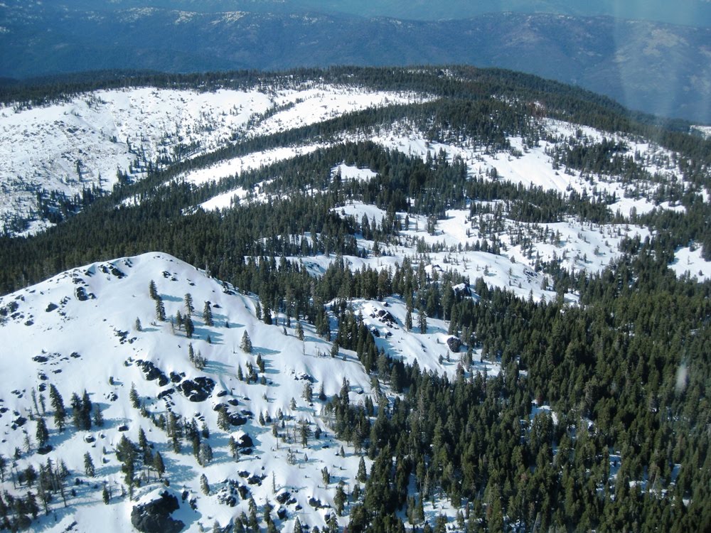
It was a great day to explore the structure of the wave and to predict where it would be found. We flew to the north, where we would expect to encounter the wave off of Snow Mountain. Sure enough, it was there! Then we continued to Mt. St. Johns, and it wasn't there. Probably because Mt. St Johns is more of a peak than a range. So we retreated to the Snow Mountain wave, where we climbed back up close to 14,000' MSL before flying to Hull Mountain, just north of Lake Pillsbury. This photo is out of sequence, to show where we were. Lake Pillsbury is evident in the photo, just below the snow on Hull Mountain to the left of center in the picture. For those with a keen eye, the snow-capped peak of Mount Shasta can be seen in the distance to the right of center.


We didn't find much at Hull Mountain, so we returned to the predictable Goat Mountain wave and again climbed to 14,000' MSL. Kenny then suggested that we try to fly to the west to Ukiah. I said sure, why not? We flew far enough to the west, and we were still high enough, that we were able to see the beach of the Pacific Ocean (although I did not take a picture). We did not quite make it to Ukiah, but we were close. The next few photos  were taken on our return to the Goat Mountain wave. Here's Clear Lake looking from the north to the south. Mount Konocti is the predominant feature of the largest natural lake entirely in California.


We re-encountered the Goat Mountain wave and made one more climb to 14,000' MSL before returning to Williams as fast as we could as the sun was setting on the ground, even though we were in full sunlight at altitude.

The winds on the ground when we returned to Williams were 13 knots out of the north, so we had to perform the tricky north Williams landing. It is always good to have Kenny in the back seat on those days to guide you and monitor your airspeed as you descend through a very strong wind gradient!

Total flight time was exactly 3 hours and we covered about 200 miles even though we were never much more than 50 miles away from Williams.  The strongest winds aloft we encountered were about 42 knots, and the strongest lift we encountered was 8-10 knots. Outside air temperature at 14,000' MSL was -2 C, which wasn't too bad when we were flying at 50 knots in the climbs and the outside air wasn't rushing in. But when we were flying at over 100 knots, it definitely got uncomfortably cold.

Here's our flight trace from See You.


And here it is in Google Maps.


This was my first true wave flight at Williams. I had been there a couple of other days when the wave was kind of working, but not really in the full-up classical way. Thanks Kenny and Williams Soaring Center for a fantastic day!

Sunday, May 2, 2010

In-Flight Shots of 25H From 98

In my last post I included some in-flight shots of Pete Alexander in his ASG-29 (98).  I commented that I looked forward to seeing the shots he took of us in the ASH-25 (25H).  Well, here they are.

Here we are sharing a thermal before we set up for the photo opportunity.  Can you say wings?!?!


Here we are coming up on his left side.


This is my favorite.


And here we are separating to go our own ways.


Great shots Pete!  Thanks for sharing them!

Thursday, April 22, 2010

Third Flight in the ASH-25

I paid my fifth visit of the year to Williams Soaring Center on Saturday, April 17, 2010. And this time Kenny Price and I flew in the ASH-25 once again!

This turned out to be my second longest flight out of Williams, trumping the flight South to Lake Berryessa described in the last post. This time we went North. We towed out to Walker Ridge and climbed in thermals to the Tree Farm Gate. From there we made our way to Goat Mountain and got into convergence lift. Then we flew North to Snow Mountain, Mount St. Johns, Sheet Iron Mountain, Alder Springs, turned Black Butte Mountain, returned to Walker Ridge and flew South to Rumsey Gap before we returned to Three Sisters and finally Williams. Another incredible fight out of Williams!

Here, we are heading North after leaving Mount St. Johns.  There were plenty of clouds to mark the convergence line.


The next two shots are of Black Butte Mountain, the farthest North that we progressed that day.


Here, we are still in the vicinity of Black Butte Mountain. Again, the wings of the ASH-25 just seem to go on forever!


We are heading back to the South here and that is Mount St. Johns to the East of us.  If you look closely, you can see another glider heading North just to the right of the summit.


In the next two shots we are approaching Snow Mountain. The trees have been destroyed by wildfire and they cast long shadows in the late afternoon sun.


The sun burst reflection off the canopy made the cornice of Snow Mountain appear to be the recipient of divine intervention!


We progressed back down to Walker Ridge and united with Pete Alexander (98) in a thermal at the South end of the Bear Valley near the 16/20 Intersection.  After thermaling with him for a brief time, we decided to set up for a photo opportunity. Here he is in the next three shots. I look forward to seeing the photos he took of us!


We left Pete and headed South to Rumsey Gap before returning North to Three Sisters and heading back to Williams. Here we are heading for home at 120 Knots, which is about 140 MPH!


This is our GPS trace from the flight.


Flight time - 3.4 hours, Distance covered - 203 miles

Sunday, April 18, 2010

Great Flight in the Duo Discus

I paid my fourth visit of the year to Williams Soaring Center on Saturday, April 3, 2010. Once again to fly with Kenny Price, but this time not in the ASH-25, but rather the familiar Schempp-Hirth Duo Discus. Based on the morning conditions, we decided that the day would not warrant the effort of assembling the ASH-25. Boy, were we wrong! Besides, the Duo Discus was already conveniently assembled for flight and available.

This turned out to be my second longest flight out of Williams, and it was the farthest South I had ever flown there. After towing out to the first mountain range, we flew South to Lake Berryessa, returned and made an attempt at Gold Mines, got low at the HWY 16/20 Intersection, got onto the Walker Ridge, made an attempt to Goat Mountain, returned to Williams, and then went most of the way to Colusa before returning to land.

What an incredible flight! No regrets that we weren't in the ASH-25, but I can only imagine that our "attempts" may have been more successful if we were!

Here, we are returning to the North after almost making it to the dam at the South end of Lake Berryessa.


The clouds show what and incredible post-frontal day it was!


Here's a good shot of Kenny working hard!  I love the reflections of the wing and the tail surfaces on the canopy! Not to mention Kenny's furrowed brow!


This is our GPS trace from the flight.


Lake Berryessa is at the bottom of the map, Clear Lake is at the left edge of the map, and Indian Creak Reservoir is in the upper left quadrant.

We never got above 7,000 feet MSL, and it was cold that day! The Duo Discus' temperature gauge indicated that it was +3 C outside most of the flight. By the end of the flight my feet were frozen!

Flight time - 3.6 hours, Distance covered - 178 miles

Tuesday, February 23, 2010

First Flight in the ASH-25

A new year and a time for new soaring experiences! This was my second flight of the year and my first in one of the highest performance gliders in existence. I flew the Schleicher ASH-25 with Kenny Price at Williams, CA on Saturday, February 13, 2010. Kenny and I had been attempting to fly this glider for a year, only to have weather, scheduling, and availability thwart our attempts. The owner of this glider typically relocates it to Ely, NV from June through September each year. So the window of opportunity to fly it at Williams is somewhat limited.

Kenny and I were scheduled to fly it in December, 2009 and January, 2010 only to be "weathered out" by fog and rain on four attempts. However, I did make the trek to Williams on our first attempt in December, knowing that I would not fly it that day, and sat in it in the hangar for almost an hour getting familiarized with the cockpit and the layout of the controls. The endeavor was completely worthwhile as the ASH-25 was a totally foreign ship to me. Not only was the layout of the instruments and avionics different than what I was accustomed to in the Schempp-Hirth Duo Discus, the ASH-25 is also equipped with performance flaps and therefore has an extra control handle.

Here it is as we are preparing to move it to the launch point. It has an 83 foot wingspan, only 10 feet shorter than a typical Boeing 737. The "unicycle" wheels you'll see attached to the wings in the next few photos are only used to support the long wings in order to facilitate ground handling. They are removed before flight.


Here's Kenny backing it out of its parking space with a golf cart for the trip to the launch point.


The performance provided by the long wings of this glider give it a 57-to-1 glide ratio (commonly printed as 57:1). This means that it will go forward 57 of anything from a height of one of the same anything. For example, it will go 57 feet forward from 1 foot of height. Or, it will go 57 miles forward from 1 mile of height. That is, in calm air of course. In air sinking at a rate of 1,000 feet per minute, all bets are off!

It was a busy day at the glider port as this was one of the nicest days of the year and pilots were anxious to get out and fly. Notice all the open glider trailers and assembled gliders ready to go.

Here's the front instrument panel. It is outfitted with state of the art avionics. Unfortunately, we didn't get much use of them as the computers were still loaded with databases for flight in Ely, NV! But that didn't matter much as we knew the conditions weren't right for a long flight where we would really be relying on the information they provide. We had all the basic instruments needed for safe flight (airspeed indicator, altimeter, variometer, and the all mighty yaw string!). And besides, the purpose of this local introductory flight was just to get familiar with how the ASH-25 flies.


Here's the front cockpit. The black handle on the right is the landing gear control. The blue handle on the left is the dive brake control. And the black handle on the left controls the flaps.


We decided to take a high tow out to Goat Mountain so that we would get a decent amount of flight time. Here, we are on tow approaching the first range of foothills at the Western edge of the Sacramento Valley. The wings seem to go on forever!


Looking right.


We towed to 7,000 ft. MSL and got off tow just East of Goat Mountain, which was covered in a fresh layer of snow. The air was perfectly calm. Good for an introductory flight, but not good for a soaring flight. The plane flies like a dream, and with a glide ratio of 57:1 your decent is nearly unperceivable. However, I quickly found that flying this glider is unlike any I've ever flown. It was like learning to fly from scratch all over again.


We made or way back down to the Walker Ridge searching for any signs of lift, to no avail. I did not take many pictures during this flight as I was selfishly reluctant to turn the controls over to Kenny. But I didn't feel too bad because by his estimation, Kenny has nearly 700 hours in the ASH-25. That's almost twice my total flight time!


After no luck on the Walker Ridge, we made our way back into the Sacramento Valley where we did find some weak thermals which extended the flight.


The road beneath us in this photo is Highway 20 as it crosses the first range of foothills West of Williams. The three peaks in the upper right of the photo are called Three Sisters.


The recent heavy rains had turned the foothills a rich emerald green. This won't last for long as the scorching heat of the Sacramento Valley will turn them brown in short order.


Several gliders that were flying to the East of us noticed that we had found a decent thermal. Here's one of them coming over to join us.


At this point we were only at about 2,000 feet MSL and still about 10 miles to the West of the glider port. That is just about the minimum height required to arrive back at the glider port and still have 1,000 feet to perform a normal pattern entry and landing.


The glider beneath us is being flown by Sergio Colacevich, a renowned pilot and one of the winners of the Barron Hilton Cup in 2002.  It is my understanding that seeing him below you is a rare occurrence!


What an incredible experience this introductory flight was! It was a 1.6 hour flight in an incredible glider. I look forward to many more great flights in it!


A very special thanks to Kenny for continuing to come out of "retirement" to fly with me. And more importantly, to his wife, Suzanne, for letting him continue to do so!


Epiblog
Several days after this flight, I learned of the untimely passing of one of my many soaring mentors, John Campbell, PHD, of Mile High Gliding in Boulder, CO.


John encouraged me to take my first steps into the world of high performance gliders in May of 2007. After a number of flights with him in their Grob 103C, he suggested that I was ready to take my first flight in the Schempp-Hirth Duo Discus.


I eagerly agreed to his suggestion as we scheduled the flight, only to find that when the day arrived, I was completely at unease by my unfamiliarity with this new glider. He obviously sensed my discomfort and with a reassuring voice said "Pat, let me demonstrate the takeoff". Shortly after takeoff, he turned the control of the glider over to me and I never looked back. He had ushered me across the threshold into a new realm of motorless flight.


For this, I am eternally grateful and I would like to dedicate this flight, my first in the ASH-25, to his memory.